Until 1841 they were essentially head-counts. From 1841 an increasing amount of information was collected. Individual’s names, gender, age, place of birth, relationship, status or occupation, household composition and addresses can be read from the enumerators’ forms, available on line up to the 1911 census. The 1921 census is available on line but cannot be searched by location. Census data is valuable for family historians but can also be used to describe the character of a community. The Blythburgh censuses have been indexed from 1841 to 1911.
Map of Blythburgh village in 1925 with residents’ names written against their properties
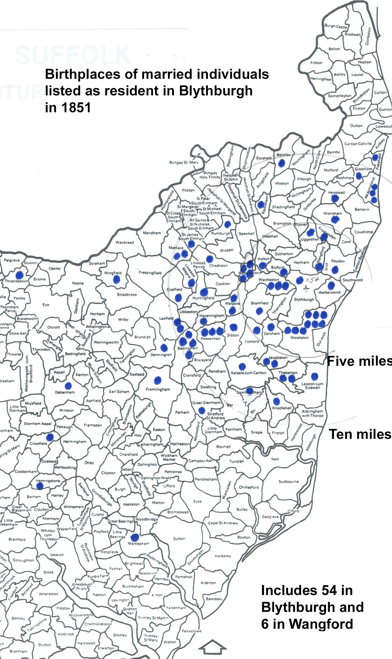
In 1851 the census listed 71 married couples, or 142 individuals. Of these, few were born beyond 10 miles from Blythburgh, just eight in east Suffolk, one in west Suffolk, and eight in other counties. So 88% of married persons in Blythburgh were born in the parish or within 10 miles. This concentration is shown in the map.
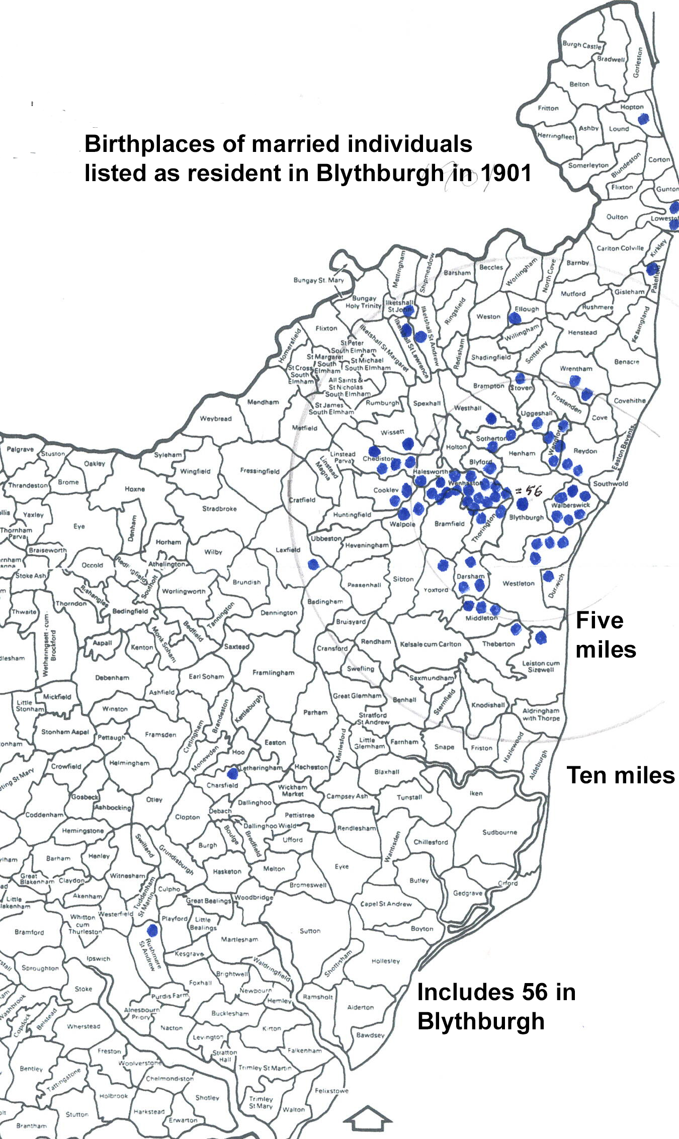
Fifty years later the 1901 census shows that Blythburgh was still largely populated by people born in north-east Suffolk. Of the 150 married individuals, 83.3% were born in Blythburgh or within ten miles. Ten were born elsewhere in Suffolk, fourteen in other counties and one overseas. Great changes were to come but the data available on line does not permit similar analyses to be done. The continuing concentration of the birthplaces is shown in the map.